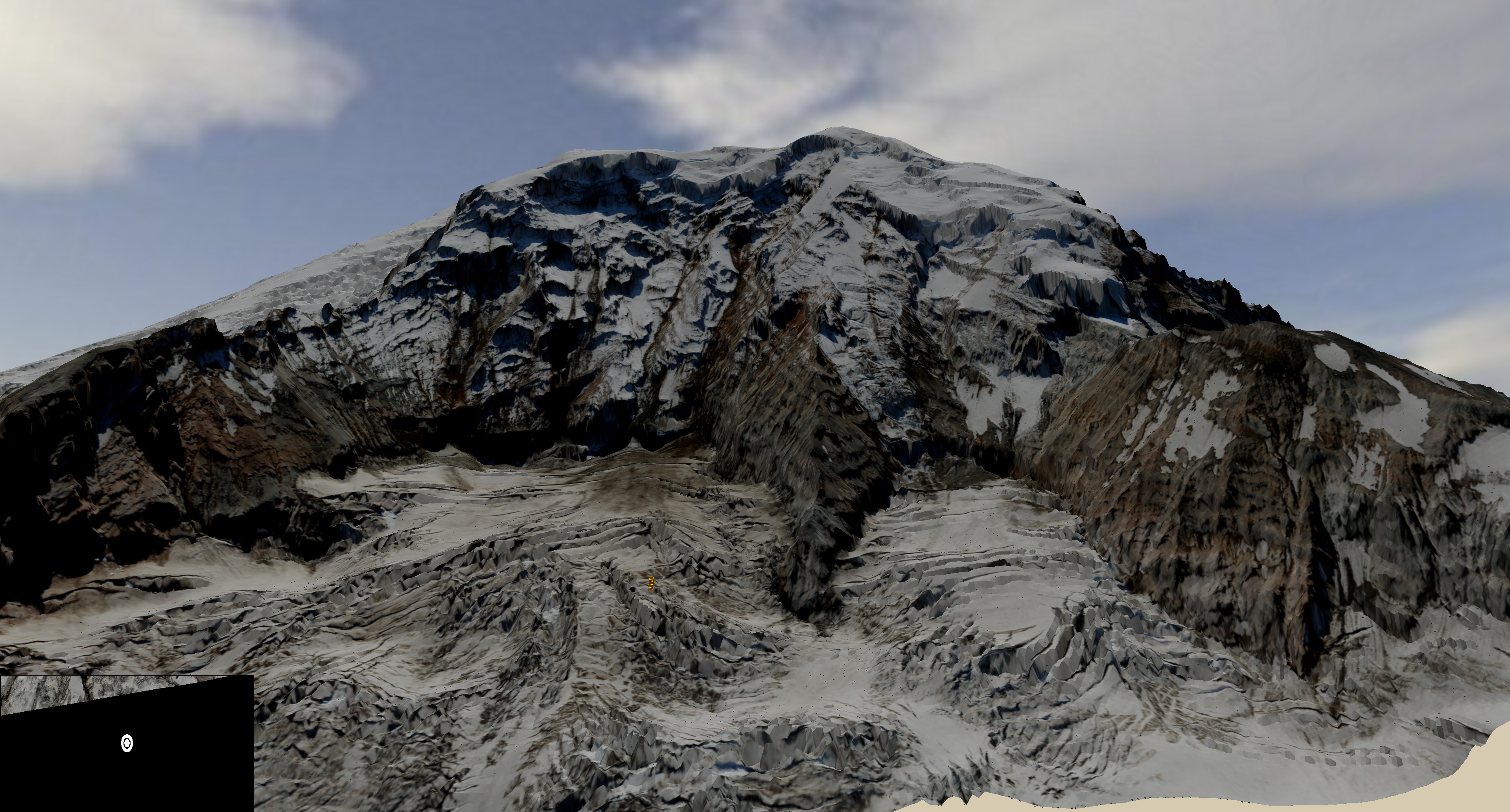
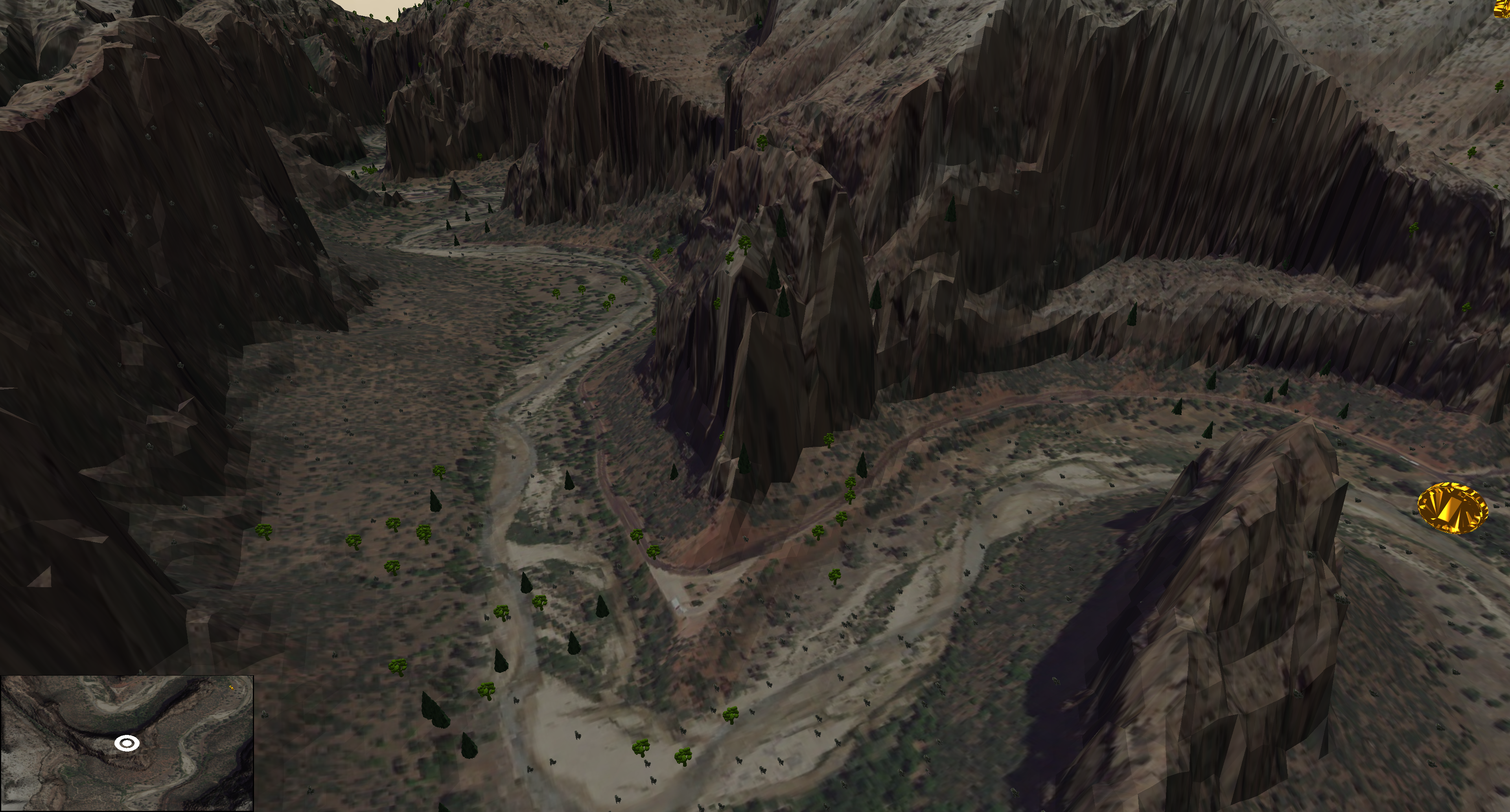
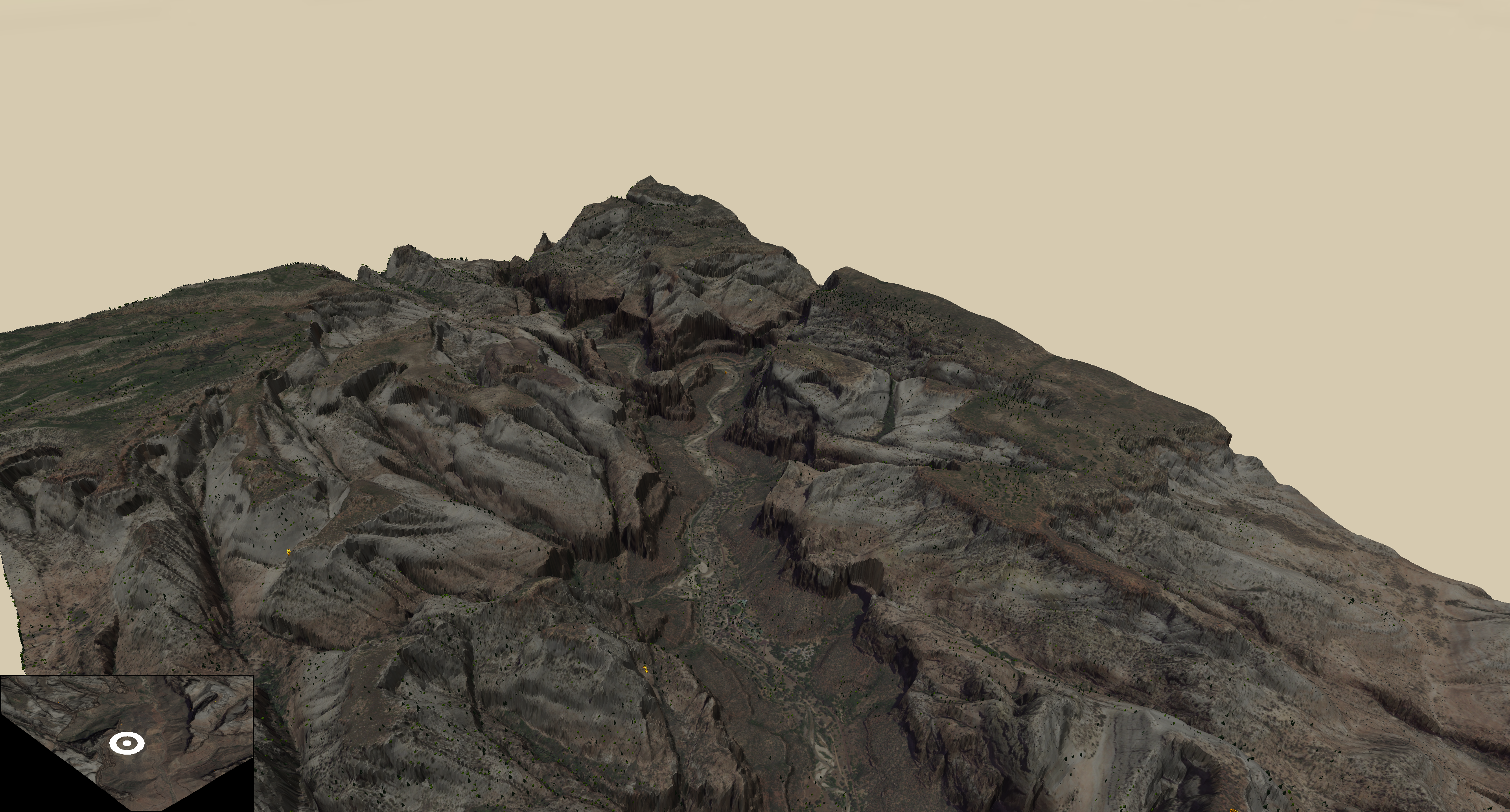
This program generates a 3D world from mapping input data. Specifially it takes in elevation and landcover data and creates a 3d world.
The elevation data is formatted in a special binary format (I created a utility to create and read it). This is to keep as much precision as will fit in 32 bytes.
This program can render anywhere in the world provided there is data for it. Eventially I would love to ask the user for a lat/lon and dynamically gather the needed data for that area.
Key Technologies
Textures, Textures everywhere
Instanced rendering - this boosted preformance by a HUGE margin.
Blinn Phong Lighting, although there is only one 'sun' per scene.
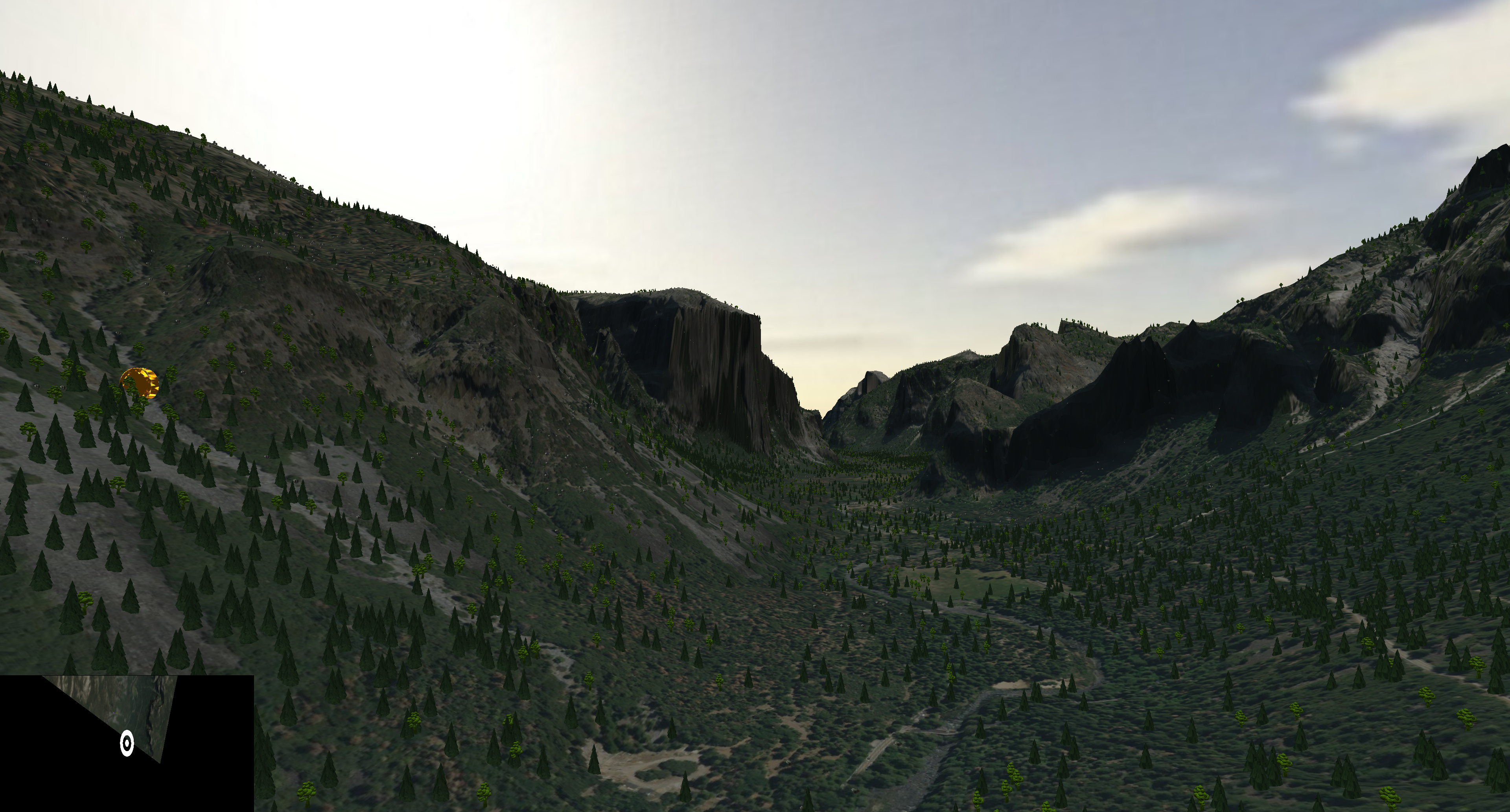
Collision Detection - Coins that can be collected and will cause something special to happen
Animation - The coins float up and down and spin
Dynamic texture generation - if a model doesnt have texture coordinates, figure out a way to texture it
Dynamic normal generation - if a model doesnt have normals, calculate them
Culling - cull all normals on the terrain that are not facing towards you. ie cull backfaces.
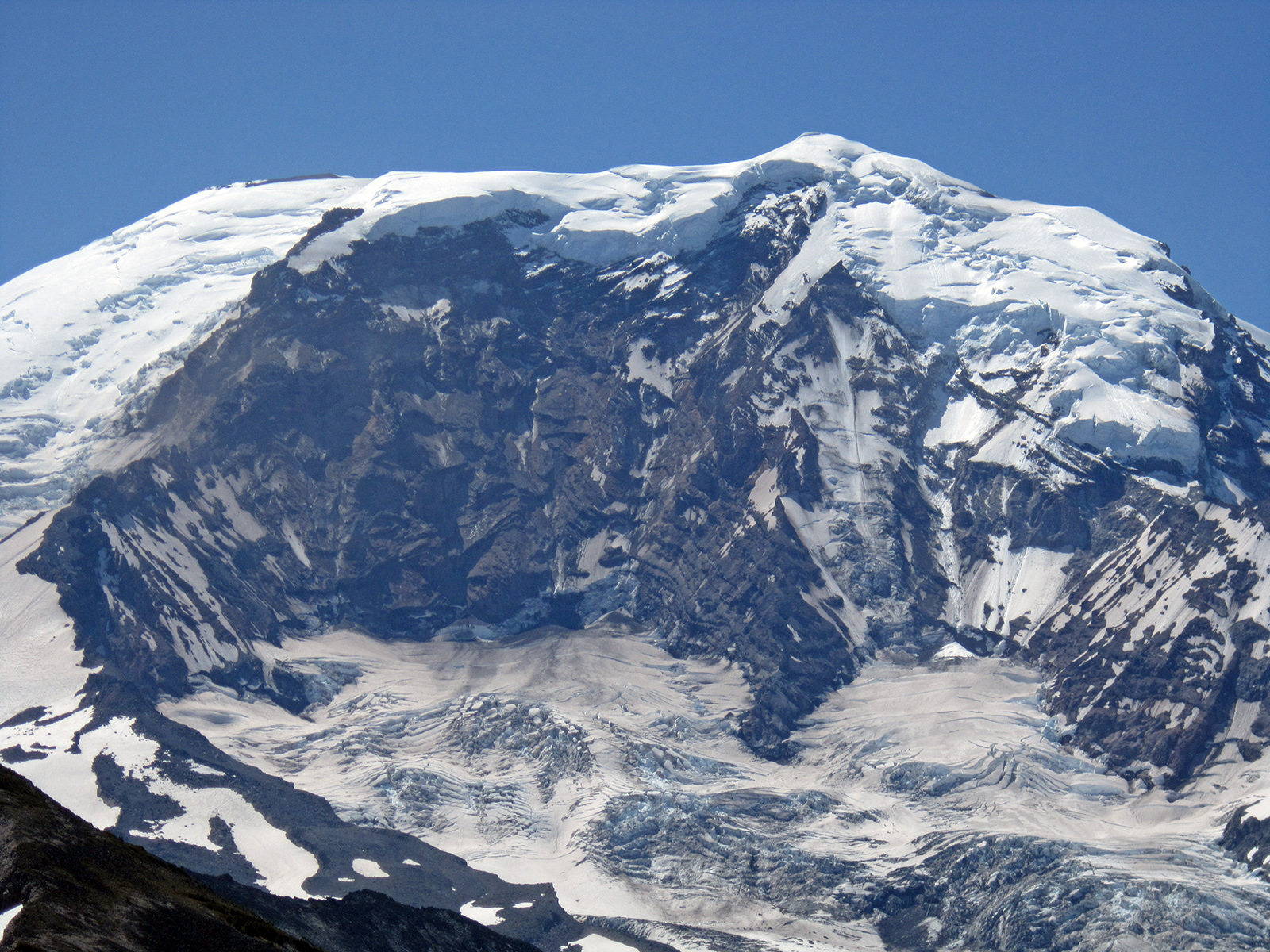
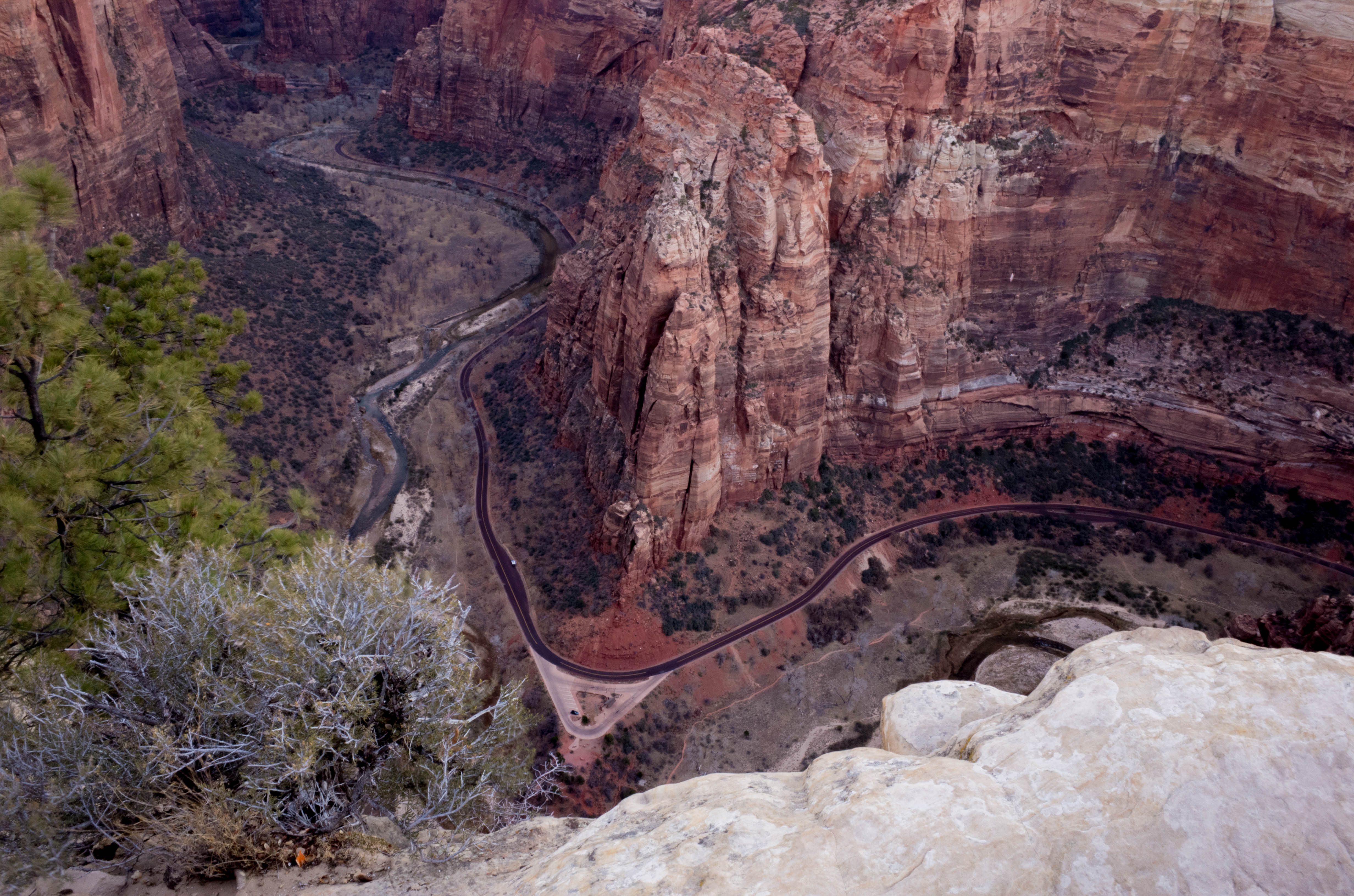
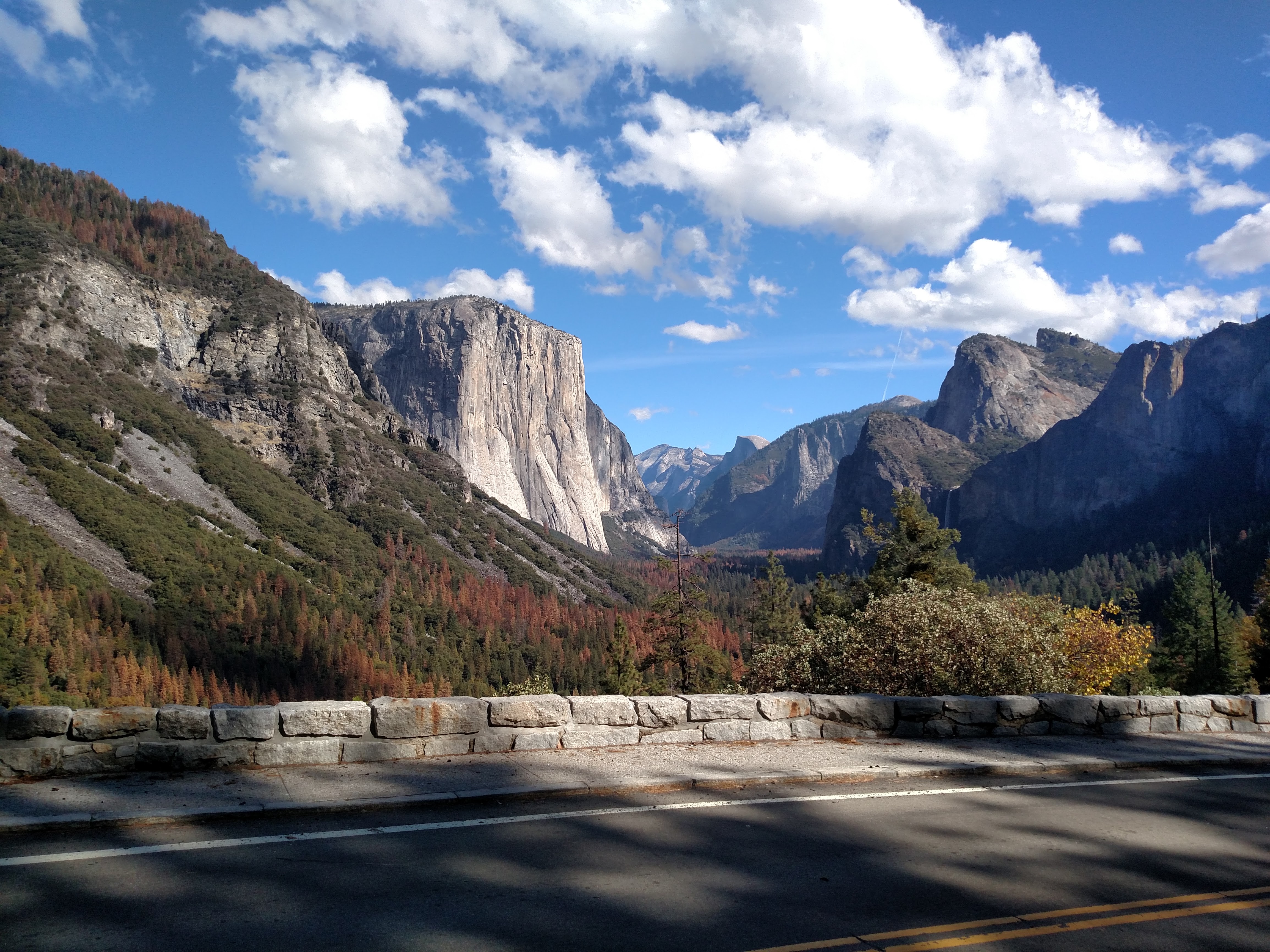
PHOTOS
Below are photo comparisons of real life vs my rendered world.