Interactive Cistern Game
Andrew CarrilloCSC 570
Winter 2013
 The Cistern Game!
Background
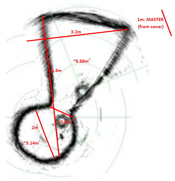
The International Computer Engineering Experience (ICEX) involves the investigation of ancient underground water storage and distribution systems, primarily cisterns, through the use of a micro-ROV. Sonar sensors mounted on the ROV are used to obtain information from these cisterns, and 3D models are then re-constructed.
Much of this research takes place on the island nation of Malta, where water scarcity is a crucial issue. In order to address this issue and make it more accessible to a wider audience, an interactive game has been developed in order to assist Maltese citizens in visualizing their water usage and storage.
Concept
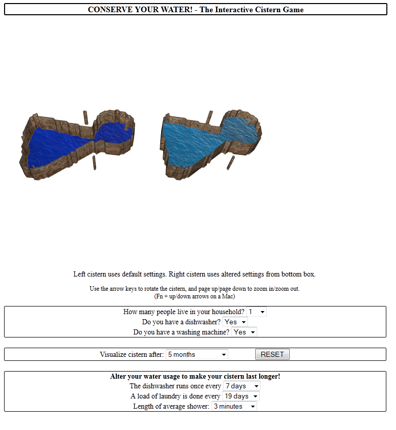
A cistern from a typical Maltese family home was chosen for the visualization. A few basic inputs are obtained from the user: number of people living in the household, whether or not there is a washing machine, and whether or not there is a dishwasher. The user is then able to click through successive months, and visualize the changing level of their cistern, which takes into account the average monthly rainfall of Malta.
Once the user sees how quickly the water in their cistern is depleted, they are encouraged to alter their water usage through three additional metrics: days between running the dishwasher, days between loads of laundry, and average length of a shower. In order to portray the difference affected by these altered metrics, two cisterns are displayed side-by-side in the graphical viewer: one with default settings, and one utilizing these altered metrics.
Implementation
Javascript functions for calculations of cistern metrics and water levels, default and altered, were implemented. The cistern visualizations were developed in a WebGL context.
This project was built on the backbone of Vanessa Forney's graphics project, developing the original static cistern models.
A MATLAB script was written in order to quickly test the metrics used for implementation of the depletion of the water level. An image is also included of the sample sonar scans used to not only re-construct the 3D model of the cistern, but also to determine the approximate volume of the cistern.