Hiking in SLO
TriTip Challenge
With San Luis Obispo's beautiful mountainous range and sunny California weather, hiking is a beloved activity by many here! This list is made up of the TriTip Challenge, a triad of the most popular and well known trails in SLO!
-
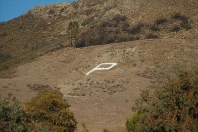
Cal Poly "P"
"Cal Poly P" hike is a popular and relatively easy trail located near the Cal Poly campus. The trail offers two routes, one more steep than the other, and takes around 20 minutes to complete. Many students enjoy using the hike as a way to relieve stress or even to paint the "P" with permission. The summit of the hike offers a beautiful view of the Cal Poly campus and the surrounding hills, making it a popular spot to catch the sunset.
-
Cerro San Luis Obispo
The Madonna hike, also known as the Cerro San Luis Obispo, is recognized by the large white "M" on its west side, which is said to represent Mission High School and not the Madonna the owner of the land, despite the misconception. The hike can be accessed through multiple trails, with the most popular starting off of Marsh Street. The hike starts in grassy hills and becomes steep as it goes up the mountain, and the summit offers a great view of San Luis Obispo County. The trail is around 4 miles long.
-
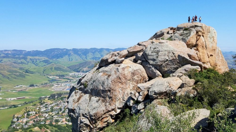
Bishop's Peak
Bishop's Peak is the final hike in the Tri-Tip Challenge and is known for its steep incline leading to the summit. Despite this, it is still a popular hike among the residents of San Luis Obispo. The peak stands at 1,559 feet and the hike is about 3.5 miles long. There are three different trail options that start from Highland Drive, Foothill Boulevard, and Patricia Drive. Upon reaching the summit, hikers can rest at the two memorial benches or continue on for some rock climbing to reach an even higher point. According to a Cal Poly student, Jay Matsumoto, "It is the highest point in San Luis Obispo, so it provided the best view."